Trail Walking Le Castellard-Mélan - Cretes du castellard et anciens chemins de Sisteron, col de Mounis, église et point de vue de depuis Mélan - Photo

Cretes du castellard et anciens chemins de Sisteron, col de Mounis, église et point de vue de depuis Mélan

 jalien04
jalien04

User

© OpenStreetMap contributors
Length
Length
13.9 km
Max alt
Max alt
1353 m
Uphill gradient
Uphill gradient
547 m
Km-Effort
Km-Effort  
21 km
Min alt
Min alt
977 m
Downhill gradient
Downhill gradient
544 m
Boucle
Boucle
Yes
Creation date :
2021-06-26 14:04:52.384
Updated on :
2021-08-01 15:16:09.649

(0 Reviews)

Walking
Walking
4h45
Difficulty : Medium

Scan this QR Code to open this trail in the SityTrail application

FREE GPS app for hiking

Logo SityTrail SityTrail

IGN / Geographical institutes

Download SityTrail from the App Store Download SityTrail from Google Play

Logo SityTrail SityTrail World

The world is yours!

Download SityTrail from the App Store Download SityTrail from Google Play Download SityTrail on Huawei AppGallery

About

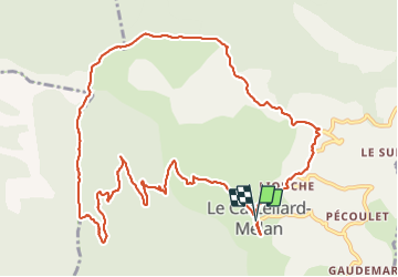
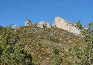
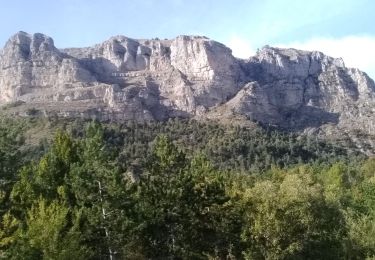
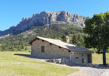
Trail Walking of 13.9 km to be discovered at Provence-Alpes-Côte d'Azur, Alpes-de-Haute-Provence, Le Castellard-Mélan. This trail is proposed by jalien04.

Description

Départ du hameau du Castellard, Mairie du Castellard-Mélan, RD17 Point Kilométrique 66, stationnement public de part et d'autre du hangar agricole.
à 180m en direction du Sud, deux tables de lecture de la géologie et du paysage.
en direction du Nord, prendre le chemin rural à 100m, puis à 500 m environ sur la gauche qui descend alors vers le ravin des Graves. Après l'avoir traversé, prendre à angle droit sur la gauche le long du fil de clôture et commencer la montée vers la crête, puis suivre le sentier GTPA sur la droite en crête jusqu'au col de Mounis. Rejoindre Mélan, puis couper par le sentier descendant au niveau de la borne incendie n°5 jusqu'à la RD3 jusqu'au réservoir, puis suivre le fléchage Le Castellard par le sentier et finir sur la RD17 en quelques 700 m.

Elevation profile

Photos

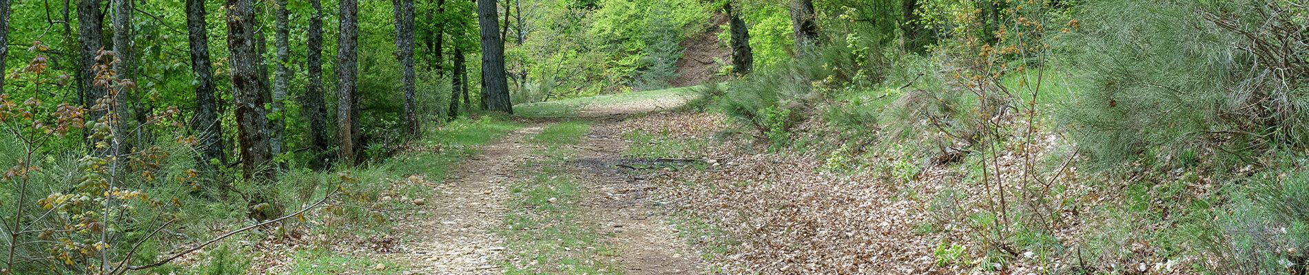
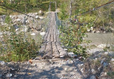
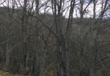
53 photos in total. Please click on a photo to see them all in the gallery.

Positioning

Country:
France
Region :
Provence-Alpes-Côte d'Azur
Department/Province :
Alpes-de-Haute-Provence
Municipality :
Le Castellard-Mélan
Location:
Unknown
Start:(UTM)
270195 ; 4896713 (32T) N.

Trails nearby

Trail Walking Saint-Geniez - S GENIEZ . ABROS . LA FOREST . COL DE MOUNIS . O L M - Photo
Walking
GUIDE
RobinMicheline

Walking

Difficult
(1)
Saint-Geniez, Provence-Alpes-Côte d'Azur, Alpes-de-Haute-Provence, France
12.5 km | 20 km-effort
4h 33min
Yes
Trail Walking Hautes-Duyes - geruen sentier des chamois  - Photo
Walking
GUIDE
Danielba

Walking

Very difficult
(1)
Hautes-Duyes, Provence-Alpes-Côte d'Azur, Alpes-de-Haute-Provence, France
11 km | 22 km-effort
7h 15min
Yes
Trail Walking Le Castellard-Mélan - MELAN . Col de Mounis  , sommet du Corbeau o l s - Photo
Walking
GUIDE
RobinMicheline

Walking

Medium
(1)
Le Castellard-Mélan, Provence-Alpes-Côte d'Azur, Alpes-de-Haute-Provence, France
12.8 km | 19 km-effort
4h 30min
Yes
Trail Walking Thoard - la Bigue par Thoard - Photo
Walking
FPOL04

Walking

Medium
(1)
Thoard, Provence-Alpes-Côte d'Azur, Alpes-de-Haute-Provence, France
17.5 km | 30 km-effort
7h 43min
No
Trail Walking Le Castellard-Mélan - Autour de Fontbelle 18/12/2024 - Photo
Walking
GUIDE
R@ph

Walking

Difficult
Le Castellard-Mélan, Provence-Alpes-Côte d'Azur, Alpes-de-Haute-Provence, France
9.4 km | 15 km-effort
3h 24min
Yes
Trail Walking Hautes-Duyes - Crête de Géruën descente sud Est - Photo
Walking
GUIDE
nadd73

Walking

Difficult
Hautes-Duyes, Provence-Alpes-Côte d'Azur, Alpes-de-Haute-Provence, France
11.6 km | 22 km-effort
5h 18min
Yes
Trail Walking Saint-Geniez - 28-10-2022 Tour du Dromon - Photo
Walking
GUIDE
Kargil

Walking

Easy
Saint-Geniez, Provence-Alpes-Côte d'Azur, Alpes-de-Haute-Provence, France
12.8 km | 19.7 km-effort
4h 12min
Yes
Trail Walking Hautes-Duyes - sommet Geruen et son pas - Photo
Walking
GUIDE
nadd73

Walking

Difficult
Hautes-Duyes, Provence-Alpes-Côte d'Azur, Alpes-de-Haute-Provence, France
14 km | 28 km-effort
7h 6min
Yes
Trail Walking Le Castellard-Mélan - AUTHON Fontbelle,  piste forestière du Pras au pied de Gueruen,  col d Ainac AR o l s - Photo
Walking
GUIDE
RobinMicheline

Walking

Easy
Le Castellard-Mélan, Provence-Alpes-Côte d'Azur, Alpes-de-Haute-Provence, France
14.7 km | 21 km-effort
3h 37min
Yes


Close
My subscriptions